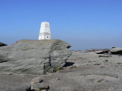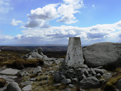
Also known as triangulation stations or OS columns the first trig points were erected by the Ordnance Survey in 1935 as part of a long term project to re-map Britain. Overseeing the project, and the man credited with the design on the pillars was Martin Hotine CMG CBE (1898-1968), the head of the Trigonometrical and Levelling Division of the Ordnance Survey.

The trig points were usually situated on the highest ground in a particular area and the idea was that in clear weather it would be possible to see at least two other trig points from any one trig point. By sitting a theodolite on the top of the pillar it was thus possible to take careful measurements of the angles between the lines-of-sight of the other trig points. This process called 'triangulation' enabled the Ordnance Survey to construct a highly accurate measurement system that covered the entire country. The OS Landranger and Explorer maps we use today are a direct result of this project.

While many trig points are to be found marking the summit of a hill or mountain it was more important to the surveyors when selecting a spot that the trig point would be visible from at least two other trig points. This is why in some upland areas, particularly the Dark Peak area of the Peak District and the North Pennines, trig points are often found not on the wide flat summits but near the edge of steeper gradients. A classic example of this is the vast Kinder plateau where not one but three trig points have been sited at strategic points though not one of them is close to the actual summit of the mountain.

There were initally 300 'primary' trig points constructed across the country which over the next 30 odd years were supplemented by over 6,000 more. Over the 300 primary trig points a total of 18 were sited in the Pennines. From south to north these are as follows; Merryton Low, Harland Edge, Kinder Scout (North), Margery Hill, Black Hill, Winter Hill, Boulsworth Hill, Ilkley Moor, Ward's Stone (East), Great Whernside, Whernside, Water Crag, Cross Fell, Collier Law, Cold Fell, Sighty Crag, Tosson Hill and The Cheviot.

I have often wondered what it must have been like for the people whose job it was to site and erect the pillars. For a start the Ordnance Survey must have initially had to negotiate access with local landowners. Presumably the succes or otherwise of these negotiations had a major impact on the actual positioning of certain trig points.

While many trig points, particularly the lower level ones, are easy to access there are also some that were situated in particularly remote and hard to access areas. Remember this was in the days before the general public had access to much of our upland areas and there wasn't the network of paths and tracks that we enjoy today. Even today there are plenty of trig points that can only be reached by a long pathless march over rough terrain. Think what it must have been like to not only get to the projected site but to also carry the tools and materials for actually building the pillars.

On the other hand what a wonderful task it must have been!! Maybe I'm just being a romantic but surely being out on the hills everyday building trig points beats working in an office. I'm certain that the OS surveyors must have had a fair few adventures along the way too, both in dealing with the elements and the local population. Were it not for the fact that many of those responsible for building the first trig points are now long since dead I imagine one could compile quite an entertaining book of anecdotes about their adventures.

In my next blog I'll look at trig points in the 21st century.
Nice website enjoyed it mate.
ReplyDelete