Thursday 31 December 2015

Walking Review 2015

It is that time of year again where I dust off my Blogger page (I really must integrate this properly into my website) and submit my walk review for the year. While I almost always post what an excellent year it has been for walking I think that has been especially true of 2015. First though some stats, in total I managed 67 walks over the course of the year (just one short of 2014) during which I clocked up around 520 miles in distance and over 85,500ft of ascent, not bad going!! 


My longest walk of the year, a near 15 mile exploration of Whernside and Scales Moor.

 
Approximately half the distance I walked was in the Yorkshire Dales. Indeed the 33 walks I managed in the Yorkshire Dales in 2015 equals my best since 2005. The Yorkshire Dales has always been the area I return to the most but for some reason it seems that this year I have been on a voyage of discovery in the Dales, not only finding new places to walk but retreading some of my early adventures. In fact one of the highlights of my walking year was enjoying the superb views from the likes of Buckden Pike, Fountains Fell and Nine Standards Rigg that were denied to me in earlier visits.

It was third time lucky for me when I finally got a good view from Nine Standards Rigg.
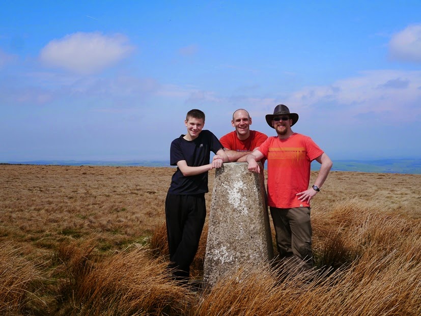
During the course of my wanders in the Dales I finally got round to visiting all the trig points within the boundary of the National Park when I bagged the trig on Calton Moor at the beginning of December. Meanwhile, back in June, I revisited the top of Yockenthwaite Moor and in doing so completed my second round of 2,000fters of the Dales.


By the trig point on Calton Moor, the final one I hadn't visited in the Yorkshire Dales.


 Although not comparable in terms of the quantity of walks I also had a fairly productive year in the North Pennines, with a total of 8 walks covering almost ninety miles of this often overlooked Area of Outstanding Natural Beauty. Highlights of 2015 included a superb walk contrasting the dramatic scenery of High Cup and the tarn laden moorland of Backstone Edge. Another grand walk was the linear walk from Murton to Stake Rigg visiting all the major summits in the Warcop Range.

Heading towards Mickle Fell on a cracking linear walk across the Warcop Range.

 
By concentrating mainly on the Dales and North Pennines I did somewhat neglect the more southerly Pennine areas, something I will have to try and make up for next year. Away from the Pennines I fulfilled a long held desire to go walking in the Galloway Hills in south-west Scotland. The walk over Merrick, the highest in the Southern Uplands, gave me a real taste of what a rough, lonely and utterly beautiful walking area it is. If I can get over my distaste for driving long distances it is definitely an area I'd like to explore further.

The Minigaff Hills in Galloway as seen on my return to Loch Trool from Merrick.


While I've always enjoyed a good waterfall I think it is fair to say that in 2015 I've gone a little bit waterfall mad. This is partly because I've finally cracked the art of getting a good waterfall shot (thanks Tim and Jack!). Perhaps also it is just a reflection of my obsessive nature and the need to tick off lists of targets. Having visited just about every summit, trig point and tarn in the Dales perhaps it is unsurprising that waterfalls would be next. On the other hand it could be that they are just so damn beautiful.

 
Aysgill Force, one of a number of beautiful waterfalls I visited in 2015.


Weather-wise I personally can't have too many complaints, indeed for the first ten months of the year the weather was remarkably kind. I didn't get wet very often, the skies were remarkably clear of haze and nor was it too hot during the summer. Of course it all started to go a bit wrong at the end of the year. While there has been a lot of press coverage of the flooding in December the wet weather really started at the beginning of November. The horrendous scenes we've seen on our television screens are a result not just of heavy rainfall over a few days, but from prolonged wet weather stretching back almost two months. It has stopped me from heading out a few times but that is but a mild inconvenience compared to the pain and misery it has inflicted on communities that have been flooded. 

Water everywhere above Cray Gill after the start of the heavy rain in mid-November.


2015 saw a record number of visits to my My Pennines website. In total the website saw over 78,000 visits during the course of the year, a 13% increase on the number of visits in 2014. In addition to a record number of annual visits 2015 also saw a record month in August when over 8,500 visitors came to the website. Strangely the most popular landing page continues to be, for the third year running, a walk I did on Winter Hill back in 2010. The My Pennines Facebook Page also continued to grow and with one day of the year to spend I reached the milestone of 1,000 likes. Thanks to everybody who has supported my website, Facebook page or Twitter Feed during the course of the year. Truly it would not be worth doing all this without your support.


My friend Wally on Wild Boar Fell's Nab, visited on one of my favourite walks of the year.

As always at this time of year I not only reflect on what I've achieved over the last 12 months but look forward with anticipation to what I hope to do in the next year. I've already started planning my walking itinerary for the coming year and unsurprisingly it includes more walks in the Dales and lots more waterfalls! In addition to making up for hardly visiting the South and West Pennines in 2015 I also hope that 2016 will be the year that I finally get round to visiting Kinder Downfall.

Watergrove Reservoir and Brown Wardle Hill on my only walk in the South Pennines in 2015.

Finally, as has become a tradition, here are my favourite walks, views and walking moments of the year...

Top 5 Walks of 2015:


Click on the links to read the full walk reports.

  1. High Cup and Backstone Edge (North Pennines)
  2. Whernside and Scales Moor (Yorkshire Dales)
  3. Wild Boar Fell and Swarth Fell (Yorkshire Dales)
  4. Merrick (Galloway)
  5. Buckden Pike via Buckden Gill (Yorkshire Dales)
Honourable mentions go to Cray Gill, Yockenthwaite Moor, Sir William Hill, Cross Fell, Attermire Scar, Mickle Fell, Cosh and High Seat.
My walk along High Cup and Backstone Edge was my favourite walk of the year.

 
Top 5 Views of 2015:
  1. The Galloway Hills from Merrick
  2. Mallerstang from High Loven Scar
  3. Three Peaks country from Cosh Knott
  4. Murton Fell from across High Cup
  5. Westmorland from Nine Standards Rigg
The views on the descent of Merrick towards Loch Trool were simply stunning.
 
 
Top 5 Most Memorable Walking Moments of 2015:
  1. More than a 'moment'. Spending an hour and a half in the company of the red squirrels of Snaizeholme. Utterly delightful.
  2. Descending Merrick towards Loch Enoch in the heart of the Galloway Hills. A whole new world ahead of me.
  3. Standing on Murton Pike, a small island in a sea of cloud during a temperature inversion.
  4. Taking my ten year old nephew Liam to the top of Helvellyn.
  5. Bagging the trig point on Calton Moor to complete my set of Yorkshire Dales trigs.
Spending time with the red squirrels of Snaizeholme was my favourite walking moment of 2015.
 
 
5 Least Favourite Walking Moments of 2015:
  1. Being ambushed by a herd of beef bullocks in a field outside of Knaresborough. I had to take cover in a fence corner and wait for the farmer to rescue me.
  2. My Panasonic camera, having survived a number of falls, finally came a cropper on 28th March when I slipped and dropped it on Sigsworth Crags in Nidderdale. Fortunately the replacement camera I bought, an Olympus EM-10 has proven to be a more than worthy replacement.
  3. Slipping in the snow on Norwood Edge and landing knee first on a rock buried under the snow. Very very painful but thankfully no lasting damage.
  4. Forgetting to put my gaiters on before heading over the full length of Darnbrook Fell in the snow. I got so much snow in my boots I began to get seriously concerned about how cold my ankles were getting and was very relieved to get back to Arncliffe.
  5. Getting a bollocking from a farmer in Raydale after rescuing a new born lamb that had been abandoned and was freezing up on Wether Fell.
Getting hemmed in by bullocks on a field near Knaresborough
 

Friday 23 October 2015

Book Review: A Three Peaks Up and Under, Stephen C. Oldfield, Scratching Shed Publishing (2015)


I first came across Stephen Oldfield via his superbly informative blog, also named ‘A Three Peaks Up and Under’ and so when I heard he had a book coming out I knew I would have to get it. Due to my tendency to stockpile books it has taken me longer to get round to reading it than I’d hoped and in fact the book was published back in May.

Sub-titled ‘A Guide to Yorkshire’s Limestone Wonderland’, the book is the result of the author’s lifelong passion for the limestone scenery of the Yorkshire Dales and in particular the Three Peaks area of the Dales. It is, in the author’s words, “a celebration of a landscape”, both above and below ground, hence the book’s title. The author’s recollection of the origin of the phrase ‘Up and Under’, involving a toy monkey taking a 260-ft plunge off Malham Cove, is just one of the many amusing anecdotes that are sprinkled throughout the book.

After a fascinating introduction, in which Oldfield recounts the geological history of the Dales, the book is split into two main sections, ‘Up’ and ‘Under’. Rather than these being described as ‘walks’ or ‘caving trips’ Oldfield calls these ‘adventures’. The phrase is telling and it perfectly encapsulates the author’s approach to heading off to visit all sorts of features that can be found off the beaten track. 

Throughout the book Oldfield recounts times when his children have accompanied him on his adventures. Considering the horrified reaction my own daughter has whenever I mention the dreaded word ‘walk’ I realise that I’ve been making a huge mistake,  I should have been marketing them to her as ‘adventures’ all this time. Certainly the fact that the author has been able to share so much of his love for the Dales with his own children did make me more than slightly envious.

In total there are thirteen adventures above ground and seven adventures below ground, with a chapter devoted to each. Each chapter contains information on where to start, how to get there, what to take with you, an overview of the adventure and then a fairly detailed description of the adventure itself and the sights that will be seen on it.

While adventures over each of the Three Peaks are described I can guarantee that few people will have walked these particular routes. I’ve always thought that I knew them very well but even I came across a few features that I’ve missed on the slopes of Penyghent and Ingleborough. For example, after reading the book I’ll certainly be making a trip to visit the Allotment on the slopes below Simon Fell and Ingleborough. An unremarkable area as viewed on the OS map it is seemingly full of remarkable potholes, including Juniper Gulf.

While Oldfield and I are in many ways kindred spirits in our approach to exploring the Dales above ground I have to say that going underground has never really appealed to me. I’ve stood outside or above plenty of caves and potholes but apart from once going about 40m into Attermire Cave my underground experience is very limited. I’ve always thought that the dangers far outweighed the benefits. Having read this book I’m now reassessing that view.

Not that Oldfield doesn’t make it clear that these can be dangerous places - they are, particularly after rain. However, he also shows that with the right equipment and common sense some of these caves can be enjoyed by people of all ages. It is to Oldfield’s credit that he makes it all sound like so much fun, even crawling through a narrow passage or getting very wet wading through underground pools.

Overall the book manages that rare feat of being both humorous and at the same time incredibly informative in an easy to understand way. The author’s background as head of a primary school standing him in good stead in this respect. What shines through the most though is Oldfield’s sheer passion for the subject. Despite over forty years of exploring the limestone wonders of the Yorkshire Dales the author’s enthusiasm remains undimmed and positively shines through on every page.

Highly recommended.

A Three Peaks Up and Under is available to purchase online from Scratching Shed Publishing.

Thursday 1 January 2015

Walking Review 2014

Well it is fair to say that 2014 was another wonderful year of walking. The short Boxing Day walk around Swinsty Reservoir just nudged me over 500 miles for the year, spread over 68 walks. Although it was not a year in which I tackled lots of big hills I still managed to clock up almost 82,000 feet of ascent, the equivalent of climbing Everest almost three times from sea level!!

On Numberstones End enjoying one of my favourite views of 2014.
 
2014 was a milestone for me personally as it saw me celebrate my 10th anniversary of hill walking. To mark the occasion my friend Matt and I relived our first walk taking in Gordale and Malham Cove. Unfortunately there was too much water to risk scrambling up the waterfall on Gordale Scar but we still had a great time reminiscing about our early days walking together. Shame we don't get to do that very often anymore.
Reliving my first walk around Gordale and Malham
 Back in 2004 virtually all my walking activity was restricted to the Yorkshire Dales. While it is still one of my favourite destinations for a walk, these days I do like to mix things up. In addition to covering nearly all the upland regions of northern England in 2014 I also got my first taste of walking in the Shropshire Hills. Based for a week in Church Stretton I thoroughly enjoyed getting to know the Long Mynd, the Stiperstones, Caer Caradoc and the Clee Hills. Definitely somewhere I'd like to go back to in the future.

The Stiperstones, one of the highlights of my visit to Shropshire

The main reason for visiting the Shropshire Hills was to bag the five Deweys (hills over 500m) in the area. Indeed, having completed all of the Wainwrights and all of the English Hewitts and Nuttalls (with the exception of a couple on Dartmoor), ticking off my list of Deweys was the main focus of my hill bagging activities in 2014. During the course of the year I completed all the Deweys in the Peak District and the North Pennines, managed another seven in the Cheviots and several more in the Lake District. With just seven left to do now in the north of England at some point I'm going to have to drag the family down to Devon for a couple of weeks, so that I can make some inroads into the Deweys on Dartmoor and also finally complete the Hewitts as well.
On the top of Shill Moor, one of seven Deweys in the Cheviots I bagged in 2014
 
2014 also saw, after months of hard work, an upgrade to my My Pennines website. A host of additional features were added including route maps and many more photos. The changes seem to have gone down well and in April I achieved the highest number of visits to the site in a single month with 7,922. Strangely the most popular landing page continues to be a walk I did on Winter Hill back in 2010. I do find it interesting to see what my website ranks for on Google. Perhaps the most bizarre is a photo of me and Matt on Great Pinseat taken back in 2005 which ranks as one of the top Google images for the search term 'thigh slapping'!!!

Bizarrely this photo of me and my friend, taken in 2005, ranks highly in Google search for 'thigh slapping'!
 
Weather-wise I can't have too many complaints despite my long standing frustration with the accuracy of weather forecasts. Although the Met Office still got it wrong on more than a few occasions in truth I cannot recall many times when a summit view was obscured by hill fog. Nor did I get wet that often - a notable occasion being an absolute drenching during a thunder storm on Haystacks. The weather was rarely that dramatic, one other occasion that is still fresh in the mind is the sideways snow while walking across Gilmonby Moor.

On Fleetwith Pike with my nephew Liam not long before encountering a thunder storm on Haystacks.
 
By far the longest walk of the year and the most challenging one I've done for some time was the inaugural Wharfedale Three Peaks Challenge walk. Mainly to protect my knees I've generally avoided these kind of walks but I wanted to help raise money for what is effectively my local mountain rescue team. Taking part in a mass organised event was also something of a departure for me. I managed the 22 miles in 7 hours 36 minutes which I was really pleased with especially considering I'd hurt my knee a fortnight before and just ten days before the walk I was still having problems walking up and down the stairs. I may well have a crack at a few more challenge walks in 2015.

The summit of Great Whernside, the third final summit on the Wharfedale Three Peaks Challenge Walk
 
As it always does at this time of year I not only reflect on what I've achieved over the last 12 months but look forward with anticipation to what I hope to do in the next year. I do love a list and I've already got an idea of about 50-odd walks that I'm aiming to do in 2015. These include revisiting Darnbrook Fell and Yockenthwaite Moor so that I can complete my second round of 2,000fters in the Dales. Elsewhere in the Dales I plan on doing a lot more walks in Wensleydale after a wonderful walk up on to Ellerkin Scar in December. I'm also hoping to do a fair few more walks in the North Pennines as well as making my way down to the Peak District to finally visit Kinder Downfall.

After a superb walk on to Ellerkin Scar in December I hope to visit Wensleydale again in 2015.
 
Finally, after a great deal of agonising, are my favourite walks, views and walking moments of 2014...

Top 5 Walks of 2014:


Click on the links to read the full walk reports.

  1. Calders and The Calf (Howgill Fells)
  2. The Cleveland Hills (North York Moors)
  3. Dale Head to High Snockrigg (Lake District)
  4. Stiperstones (Shropshire Hills)
  5. Ellerkin Scar and Mill Gill Force (Yorkshire Dales)
Honourable mentions go to Musgrave Scar, Long Mynd, Rosedale Head, Rylstone Edge, Carter Fell, Ingleborough, Ilkley Moor and a lovely evening walk on Cracoe Fell.
The direct route up Calder, my favourite walk of 2014.
 
Top 5 Views of 2014:
  1. Wensleydale from Ellerkin Scar
  2. Crummock Water from High Snockrigg
  3. Wildboarclough from Shutlingsloe
  4. Wharfedale from Numberstones End
  5. The 360 degree panorama from Brown Clee Hill in Shropshire
Crummock Water from High Snockrigg - one of my favourite views of 2014.
 
Top 5 Most Memorable Walking Moments of 2014:
  1. Completing the Wharfedale Three Peaks Walk, my longest and toughest walk for over nine years. So glad my knees managed it!
  2. Exploring the chasm of Lud's Church in the south-west Peak District
  3. The beautiful evening sunset as I descended Ilkley Moor in late July
  4. Watching Tim and his sons, Dan and Jack, sledge down Park Fell on their backsides
  5. The moment when the sun hit the superb waterfall of Mill Gill Force. An almost mystical experience.
The sun sets as I descend Ilkley Moor, one of my favourite moments of 2014.
 
5 Least Favourite Walking Moments of 2014:
  1. The car breaking down just short of the car park on Titterstone Clee Hill. What should have been a bonanza walking day of four walks was mostly spent waiting for the car to be fixed.
  2. My camera and tripod getting blown over on Great Wolfrey Crag. Fortunately it was only the filter that was smashed, the lens was intact but I didn't know that until several hours later when the camera shop had managed to remove the filter.
  3. Losing my brown leather hat on Grassington Moor. I'd not been sure of it when I bought it the previous year in Malham but as it got more battered I got really fond of it. I'll have to buy another in time for spring.
  4. Injuring my knee coming off Cracoe Fell, a fortnight before attempting the Wharfedale Three Peaks. For three days I could barely walk up the stairs. Amazingly it recovered and with the help of a knee support I did the challenge walk without too much difficulty.
  5. Getting the worst soaking of my life during a thunderstorm on Haystacks.
My camera very nearly copped it when strong winds blew my tripod over on Great Wolfrey Crag.

Thursday 3 April 2014

Book Review: A History of the Peak District Moors, David Hey, Pen & Sword (2014)

Ever since my childhood I've had an abiding fascination with history. Although my university days, where I concentrated on ancient history, are a long time ago now I've continued to read history of all periods. Of course one of my other great passions is for walking across the hills and moors of northern England. Therefore when I was given the opportunity to review a copy of 'A History of the Peak District Moors' by David Hey I jumped at the chance.


Whether it be the natural formation of the landscape over millions of years or by the (historically speaking) more recent activities of the human race whenever we set out on a walk we are literally walking through history. In his preface Hey states that the book is, "aimed in particular at the sort of people who realise that the enjoyment of a good walk in beautiful surroundings is enhanced by a knowledge of how that environment has come to be what it is today."

Although the better walking guides often provide interesting nuggets of historical information they are not written by historians. Hey is not just a professor in local history at Sheffield University but has been a keen walker all his life and has even served as the president of the South Yorkshire and North-East Derbyshire Area of the Rambler's Association. He is therefore uniquely well qualified to write a history of the Peak District Moors. It is worth adding that the book concentrates on the area that is often referred to as the Dark Peak together with the surrounding settlements with particular emphasis on the northern and eastern moors. It is therefore not a history of the area covered by the modern day Peak District National Park.

The opening chapter looks specifically at the many layers of history that can be found in a relatively small area - the National Trust's Longshaw Estate. The remaining chapters of the book then work chronologically through history starting with the Stone Age through the Middle Ages and concludes with an interesting chapter looking at some of the early campaigns for the right to roam.

One aspect of the book, and a theme that runs through most of the chapters that I found particularly fascinating is the formation of paths and trods. Many of today's rights of way once existed for more practical purposes and the book provides numerous examples including peat roads (where villages could exercise their right to cut pear for fuel), corpse roads, holloways, sheep driving trails, turnpike roads, packhorse routes, miners paths and saltways. The latter are something I've only previously come across in the Forest of Bowland where the Salter Way is an historical route through northern Bowland. In the book Hey details the routes of a number of saltways across the Peak District moors where from medieval times onwards salt was transported from Cheshire east across the Pennines.

The book is very successful in detailing how human activity and the development of technology have had a lasting impact on the moors. For example Chapter Six charts the development of huge grouse moor estates in the late 19th century. We find out that the increase in the popularity of the 'sport' was partly due to advances in weapon technology as well as the more efficient technique of beating the game towards grouse butts. To help meet demand and increase the number of birds heather burning was introduced and drainage ditches were cut across the moors. So successful were these techniques that the Peak District moors became famous for their grouse and Broomhead Moor, near Stocksbridge, had the reputation for carrying more grouse per acre than any other moor in Great Britain. Of course shooting tracks, lodges, grouse butts and grouse feeding stations are now a regular feature of the moors.

Equally interesting is the changing attitude towards the moors. Hey quotes the negative judgement handed down by seventeenth and early eighteenth writers such as Daniel Defoe who described the High Peak as, "the most desolate, wild , and abandoned country in all England". Such opinions are a far cry from modern times when the Peak District has the distinction of being the second most visited national park in the world.

Indeed the campaign for the 'right to roam' across the Peak District moors is the subject of the final and perhaps most interesting chapter of the book. Like many people I had heard about the famous Kinder Mass Trespass of 1932 without actually knowing too much about it. Hey does an excellent job of putting the trespass into the context of other campaigns for greater access to the moors especially the efforts of the Sheffield Clarion Ramblers and their leader Bert Ward. I confess I'd not heard of Ward before but he is well served by Hey and he is clearly someone that everyone who enjoys the moors today should feel indebted to.

Although much of the book chronicles the changes the Peak District moors have experienced over the years there were also times when I was struck by the thought that in many ways things haven't really changed at all. For example, Hey recounts that in 1283 an Adam Hawkesworth purchased land to create a new farm and that over seven hundred years a Brian Hawkesworth is still farming the same land.

One gripe is a lack of maps. Some historical maps are reprinted but these are generally quite small and I felt that in certain chapters, particularly the one on the Longshaw Estate a modern map of the area would help readers who aren't as familiar with area as the author. This is just a minor complaint though and overall I found the book well written and informative. Strongly recommended for visitors to the Peak District who would like to learn more about the area's history.

'A History of the Peak District Moors' can be purchased from the Pen & Sword website.

Tuesday 31 December 2013

Walking Review 2013

Although very different from some of my more peak bagging focused exploits in the past I would definitely count 2013 as a classic walking year. In total I managed 70 walks, all but two of which were in the north of England, the most walks I’ve managed in a year since before my daughter was born in 2007. From Axe Edge in the Peak District to Hedgehope Hill in the Cheviots, from Black Combe in the Lake Distict to Dalby Forest in the North York Moors I covered around 440 miles of northern England’s footpaths, bridleways and open access land. About a dozen or so walks, mainly with my daughter, were in places I’d been to before but the majority of my footsteps were along ways new to me.


I tried, as usual, to sample as many different areas as I could. With eight walks this was by far my most productive year of walking in the North York Moors and these walks in the Moors were some of the many highlights of the year. On the flip side I only managed two walks in the North Pennines and only three in the Peak District. With the latter this was partly due to my dislike of the drive down which involves plenty of motorway driving and / or driving through or round large towns or cities. I hope to visit the North York Moors many more times in 2014 as well as visit the North Pennines more than I have in 2013.


Without doubt my single biggest achievement in 2013 was finally completing the Wainwrights. Having started off with a bang in 2005 my rate of Wainwright bagging dropped markedly following a knee injury and subsequent operation in 2009. The last couple of years being so close to completing has been something of a source of frustration so it was with large sense of relief, as well as joy, that I made it to the top of St Sunday Crag on 2nd May to finally complete the set. In addition to completing the Wainwrights I also ventured into the Duddon Valley for the first time, particularly memorable was the walk up on to Caw, a fell that is excluded from but superior to many of the fells that make up the 214 Wainwrights.
 

In making it to the top of St Sunday Crag it also meant that I’m only one top, High Willhays, away from completing all the English Hewitts (hills over 2,000ft with 35m of re-ascent). As this is situated on Dartmoor it may be some time before I complete this particular hill list. With the exception of 27 Deweys (many of which are in the Cheviots) I’ve now bagged most of the hills in the north of England that appear on the major hill lists. Perhaps it is for this reason that I’ve gradually begun moving away from planning a walk to bag a specific summit and towards planning a walk around visiting a particular feature or simply to explore an area I’ve not visited before. I think I’ve surprised myself as to how much I have enjoyed this approach and I’m planning a lot more of these kind of walks in 2014.


With my original walking partner Matt now devoted to running and limited opportunities for my wife and I to go for walks I’ve spent much of the last few years walking on my own. This began to change in February when I met up for the first time with Tim and Jack from the Bowland Walks website for a walk up on to Nicky Nook. We got on really well and we’ve subsequently met up for further walks in the Forest of Bowland as well as the Lake District, Peak District and Yorkshire Dales. In April I also met up with Wally from Sedbergh for a long promised walk in the Howgill Fells. Again we got on really well and had another fabulous walk across the Howgills in September. Forging these new friendships has been undoubtedly one of the highlights of 2013 and I look forward to more walks with Tim, Jack and Wally in the coming years.


Another enjoyable aspect of 2013 has been filming many of my walks and creating short 3-5 minute videos. I’d begun attempting this back in 2011 but my PC didn’t have the processor power to edit the files. I upgraded in late 2012 and put together my first videos at the back end of last year. This year I’ve produced over 40 videos that can be seen on my YouTube channel. I’m in no way narcissistic but I do enjoy spending the time filming short clips of me walking in the hills and being able to see myself in the environment I love so much. Similar to when I got a bit more serious about my photography, going out on a walk with the intention of creating a video adds an extra dimension to the walk, especially as you are keeping an eye out for what would make a good shot. Of course taking 100-200 photos a walk plus video footage does slow me down somewhat and the length of time it takes me to complete a walk has certainly increased in the last year!


After a particularly wet 2012 I managed to stay largely dry in 2013, a notable exception being an absolute soaking on Thieveley Pike at the beginning of December. Indeed, when looking back at the year I can have very little complaint about the weather. I certainly enjoyed more good weather than bad, which has most definitely not always been the case. Perhaps I didn’t take quite as much advantage of the late snows as I could have done but on the other hand I didn’t have the correct gear to have done so safely.

Due to the late snows there was a general delay in the appearance of springtime flowers and when they did arrive they seemed to do so in abundance. Daffodils could still be found well in to May, bluebells into June and I cannot recall seeing as many buttercups in the meadows and as much cotton grass on the moors as I did this summer. One theme of my walks from late April to early June was trying to find somewhere that the bluebells were in full bloom. From the Forest of Bowland in the west to the North York Moors in the east I went seeking bluebells with varying degrees of success. 

A major source of frustration has been the slow process of revamping my website www.mypennines.co.uk. Now four years old I wanted to give it a makeover but having spent a month on the redesign I found it extremely slow going updating rebuilding a website that now contains of 600 pages of content. However, there is light at the end of the tunnel and having not updated the ‘live’ website since May I’m hoping to get the new version online by the end of February. The time devoted to the new website has meant that numerous ideas for this blog haven't gone any further. I look forward to updating this blog more regularly in 2014.

Finally, after a great deal of agonising, are my favourite walks, views and walking moments of 2013...

Top 5 Walks of 2013:


  1. Haycock and Caw
  2. Howgills Traverse
  3. Goathland to Levisham Station
  4. Farleton Fell
  5. Gunnerside Gill and Rogan’s Seat
Honourable mentions go to the Crummackdale Horseshoe, Whitcliff Scar, St Sunday’s Crag, Melmerby Fell, Hedgehope Hill, Caw, Hole of Horcum, Bride Stones and a lovely early morning walk around Fewston Reservoir.

Top 5 Views of 2013:
  1. The buttercup filled view of Muker and Swaledale from Ivelet Side
  2. The panoramic view from Farleton Fell incorporating the Lake District, Yorkshire Dales, Forest of Bowland and Morecambe Bay
  3. The view of Ennerdale from Piper’s Crag as the light began to fade
  4. The view along Combs Edge from Castle Naze in the Peak District
  5. The view of the frost-filled Hole of Horcum
 
Top 5 Most Memorable Walking Moments of 2013:
  1. Reaching the top of St Sunday Crag, my 214th and final Wainwright
  2. Walking through the narrowest part of the spectacular Avakas Gorge in Cyprus
  3. Visiting the magical waterfall of Mallyan Spout near Goathland
  4. Watching my nephew Liam, dressed as a Roman centurion, pretend to fight off the Pictish hordes on the top of Windshield’s Crag, the highest point of Hadrian’s Wall
  5. Rescuing a sheep that had fallen into the Lancaster Canal at Tewitfields and which was unable to get out on its own
 
5 Least Favourite Walking Moments of 2013:
  1. Suffering with some terrible blisters on a 10 mile walk in the Peak District that I’d acquired the previous day. One particular blood blister on my heel stayed with me for two months – this was all very unusual as I hardly ever suffer from blisters.
  2. Dragging my daughter around Hollybank Woods, near Ripley, in the snow on her sledge.  It was back breakingly hard work not helped by the fact that she was cold, hungry and decidedly unimpressed with my plan to get her out on a winter walk.
  3. Negotiating a large patch of wind compacted snow on my hands and knees at the top of the steep climb on to Yarlside from Kensgriff in the Howgill Fells.
  4. Taking new friends Tim and Jack all the way to Littledale in the Forest of Bowland to see the bluebells only to find that they hadn’t flowered yet.
  5. Finding a couple of dead sheep huddled together in a melting snow drift, just two of the many victims of the heavy snow in the spring.

Friday 17 May 2013

Book Review: Great Mountains Days in the Pennines, Terry Marsh, Cicerone (2013)

With the exception of those covering the Pennine Way it is very rare to see a walking guide treat the Pennines as a continuous range of hills and provide a variety of walks covering the whole region. It is more typical to find walks about specific areas, particularly the Peak District and the Yorkshire Dales. Therefore, When I saw that Cicerone were publishing a new walking guide called, 'Great Mountain Days in the Pennines' I was rather curious and more than jumped at the opportunity to review it.

 
The guide is written by the Lancashire-based writer and photographer Terry Marsh, a name that will be familiar to those who have collected a number of Cicerone walking guides. I for one found his book of walks on the Isle of Man of particular use when I spent a week on the island back in 2008. In his introduction Marsh explains that the walks in this book are largely confined to within 10 miles of the Pennine watershed, exceptions being routes on to Ilkley Moor, Pendle Hill and Ingleborough. Unfortunately this approach means that the Forest of Bowland and the West Pennine Moors, both outliers of the main range, are omitted entirely so don't expect to find a route up the likes of Winter Hill or Ward's Stone.

The 50 walks are organised from north to south starting in the North Pennines, perhaps the least visited and certainly the most underrated area in the Pennines. By happy coincidence the first walk in the book is a climb on to Thack Moor, which, following a survey proving that it reaches the magical 2,000ft mark in height, has the distinction  of being England's newest mountain . Presumably the book went to print just before Thack Moor's elevation to mountain status was known as it is not mentioned.

Each walk is generously illustrated with photos and contains an introduction, detail on the route (including OS map) and an overview 'Route Information' box that includes detail on distance, height gain, how to get there and where to find after walk refreshment. In what must surely be an editorial mistake this 'Route Information' box is missing on walks 23 and 48 (Rye Loaf Hill and Alport Castles respectively).

The walk descriptions are well written without being overly detailed. It should be noted that the book is quite large and would be quite unwieldy to carry around on a walk. This is perhaps a good thing as most of these walks definitely require the possession and ability to use the relevant map so it would be a mistake to rely on the book for direction anyway.

Occasionally Marsh lets himself go a bit with some nicely evocative passages, for example, he describes the South Pennines as, "a great swathe of harsh moors where the lovely orange and gold crystals of millstone grit have oxidised to a black that makes your eyes hurt and portrays, falsely, a land of darkness and dirt". His frequent description of the Howgill Fells as 'bosomy' will ensure that I for one will never quite look at those hills in the same light again!

Whilst opinions on the 50 best walks in the Pennines will always be a subjective one I think Marsh has, on the whole, chosen many of the routes, or at least variations that I would have picked myself. There are a few notable exceptions. It is a shame that Cold Fell doesn't feature. Not only is it the northernmost mountain in the Pennines, and one of only five Marilyns to be found in the North Pennines, it is also a great walk to the top with some stunning views. Personally I'd have liked to have also seen a walk around Crummackdale featuring Norber and Moughton, an area that is second only to Malham for limestone scenery. Finally there is Bleaklow, the omission of which from a book subtitled '50 classic hillwalking challenges' is quite frankly perplexing. Surely these were more worthy of inclusion than than some that are included and while I love the Howgill Fells did we really need three separate walks that visit the summit of The Calf?

These latter reservations aside it is a great book, especially for people who are not familiar with some of the less frequented areas of the Pennines. Marsh deserves a lot of credit for including places such as Thack Moor, Backstone Edge, Gragareth, and Thievely Pike and resisting the temptation to fill the book predominantly with routes in the Dales and Peak District. As a result even walkers, like myself, who have already explored a lot of the Pennines are likely to find much of interest in this guide.

Recommended.

'Great Mountain Days in the Pennines' can be purchased from the Cicerone website.