Sunday, 9 January 2011

An obsession with lists - my walking plans for 2011

Today it was black ice that stopped me going out for a walk. My street was like an ice rink and I witnessed one driver braving the roads skid within inches of hitting my parked car. By the time the ice had begun to melt it was too late to go anywhere. After previously being grounded by a mixture of snow and ill health it was deeply frustrating to be kept away from the hills again, particularly as it was such a nice day overhead.

My plans to visit the Scout Moor Windfarm on Hailstorm Hill were 'put on ice' today
My enforced inaction over the last few weeks has meant that I've had a lot of time to think about and plan where I want to go walking in 2011. It should be pointed out here that I like lists. In fact I love them. If I can make a list and tick things off it even better. In terms of hill walking this obsession with lists manifested itself fairly early when I discovered hill lists such as the Nuttalls, Marilyns and the Wainwrights. For me a walk always seems that little bit more satisfying if I can tick a summit off one of these lists.

On Ward's Stone, a Marilyn and Dewey that I successfully ticked off my list in 2010
When I first began working on my website just over a year ago I made the decision that I needed to try and spread my walks evenly over each of the nine areas that I had broken the Pennines down into. Guess what I did to help me do this? That's right - I came up with a list of walks for 2010.

There are positives and negatives to this approach. On the positive side it is a useful way of setting out your goals for the year and acting as a reminder of what you wanted to achieve. On the negative side the list can become a bit of chain around your neck. Even by early autumn 2010 it was obvious that I wasn't going to complete all the walks I had hoped to, a problem exacerbated by the fact that I had also begun to deviate from my plans. A list that you can tick things off is great, when you don't have the opportunity to cross things off it gets a little bit more frustrating.

Killhope Law - one of the hills on my to do list for 2010 that I failed to tick off
Anyway I've clearly not learnt my lesson as I've drafted numerous lists over the last few weeks over where I aim to go walking in 2011. A major difference this year, and somewhat ironically given the name of my website, I will probably be doing less walking in the Pennines in 2011. The main reason for this is down to another list, one of my most cherished, the list of Wainwrights.

On Cat Bells - my first Wainwright
For those who don't know the Wainwrights are a list of 214 mountains in the Lake District each of which were featured in Wainwright's magnificent 7 volume 'Pictorial Guide to the Lakeland Fells'. On 13th June 2009 I climbed Seat Sandal thus ticking off my 184th Wainwright leaving only 30 for me to climb. Unfortunately that was also the day I realised that there was something seriously wrong with my left knee. That something turned out to be torn cartilege which was repaired in an operation in December 2010.

On Seat Sandal in June 2009 - the last time I climbed a Wainwright
I've not been back to the Lakes since Seat Sandal, this was initially because after my operation I didn't want to rush back too quickly and do further damage on the steeper gradients and rockier ground of the Lakeland mountains. I also felt that after creating a website called 'My Pennines' I shouldn't then keep rushing off to the Lake District at every opportunity. While I still want to try and resist doing this I do want to try and get over to the Lakes this year and resume my quest to complete the Wainwrights.

St Sunday Crag - one of the highest Wainwrights that I've not yet visited
I'm hoping my quest to bag more Wainwrights will be aided by the other major difference to my walking plans for this year, i.e., to go wild camping. Inspired by the V-G website I had initially planned to start wild camping a few years ago but never got round to it. While I kept prevaricating Matt went ahead and bravely went out on his own and had some wonderful backpacking experiences in the Lakes and Howgill Fells.

I have now begun investing in the necessary equipment and just a few days ago bought my Terra 'Nova Laser Competition' tent and a Petzl 'Myo XP Belt' head torch. I must not also forget the ipood trowel that Matt got me for Christmas. One of the more practical tools for going wild camping it is also perhaps one of the more disturbing. Anyway I'm hoping to go for 2-3 wild camps this year starting in the Lake District and hopefully also in the North Pennines.

Sprinkling Tarn, a potential campsite for my first wild camping expedition
The North Pennines is an area I've definitely been neglecting of late. I only managed two trips last year and it was the section of my list that I really failed to get anywhere near completing. I'm not quite sure why this is, perhaps it is the long journey times to get to the areas I've not really covered or maybe (and I hate to admit this) it is just that I find certain areas of the North Pennines a little dull. Anyway I need to make a concerted effort to visit the North Pennines more often this year because if for no other reason that it is the only area in England now outside the Lake District and Dartmoor that I have not completed all the Nuttalls. High on my North Pennines list of walks to do in 2011 are Mickle Fell, Cold Fell and Burnhope Seat.

Mickle Fell - top of my 'to do' list in the North Pennines in 2011
The other Pennine area I feel I still need to visit more often is the Peak District. I've thoroughly enjoyed all my walking in the Dark Peak but the problem is again one of travelling times. For me this problem is made worse by the fact that any journey to the Peak District means driving on the M1 or M62, neither of which I particularly enjoy. While I would love to visit the south western area of the Peak District and summits such as Shutlingsloe they are just too far away to get there and back in a day so I think in 2011 my forays into the Peak District will once again be restricted to north of the Hope Valley. Top of my 'to do' list in the Peak District in 2011 are Win Hill, Howden Edge, the north Kinder edges and the Wessenden valley.

Win Hill - one of the hills in the Peak District I want to climb in 2011
I have a holiday booked in Northumberland in August so am looking forward to being able to reaquaint myself with the wonderful Cheviot hills. In order to factor in more walking in the Lakes, Peak and North Pennines I will probaby do fewer walks in the South Pennines, West Pennines, Nidderdale and Howgills. As for my first love, the Yorkshire Dales, my aim for 2011 is to continue revisiting some of the hills I walked back in 2004 and 2005. Hopefully this time on hills such as Baugh Fell I will enjoy much better weather than last time.

Hopefully when I visit Baugh Fell this year the weather will be kinder than on my last visit in 2005
Finally I will also be returning to North Wales in late spring and (back to the lists again) I'm really looking forward to ticking off some more Welsh Nuttalls. There are so many I haven't done it is difficult to choose where to start but, if given the choice of two, at the moment I'd say Cnicht and the Moel Hebog ridge. Or perhaps Rhinog Fawr and Mynydd Mawr. Or maybe Moel Siabod and Yr Aran. Oh I don't know.

Cnicht - one of the mountains I'd like to visit when I holiday in North Wales this year
So there are my plans for 2011. Just thinking about all these potentially wonderful walks has already helped me put aside the disappointment of today.

Friday, 7 January 2011

Reminiscences of 2005

I've finally finished adding all my 2005 Pennine walks on to the site so as with my earlier blog on 2004 I thought I'd share my thoughts on what was another year of discovery.

2004 will always be special as it was the year I discovered the joys of hill walking, in 2005 however I went to a whole new level both in terms of the amount of walking I did but also in terms of broadening my horizons.

Blencathra was one of the first fells I climbed in the Lake District
In my first walking season virtually all my walking was in the Yorkshire Dales, the only exception was a fairly easy walk just over the National Park boundary in Nidderdale from Pateley Bridge to Brimham Rocks.

Matt trekking through the heather to the remote summit of Meugher in Nidderdale
In 2005 I continued my burgeoning love affair with the Yorkshire Dales while at the same time sampling the walking delights in a host of other places. There were three main reasons for this. Firstly in Feb 2005 I passed my driving test. Prior to this I had been lucky enough to be chauffered about by my friend Matt as we explored the Dales together. Being able to drive gave me the independence to go walking more regularly and to go to places that Matt may not have been interested in going to.

I celebrated passing my driving test by heading out to Grassington for a walk
Secondly, my wife Lisa, following our week away in Dent in October 2004, had begun to increasingly enjoy walking herself. As 2005 wore on I found myself
increasingly going out one day with Matt and the next day with Lisa, or even on my own.

Lisa enjoying her first ascent of Pen-y-Ghent
Finally Lisa and I also bought our first tent and that year we took advantage of this by spending long weekends in places which were less practical to get to and from in a day. Our first camping trip was to Alston in the North Pennines, this was followed by trips to Hadrian's Wall, Kielder Water and then in August
2005 with our first trip to the Lake District.

Ashgill Force - one of the finest waterfalls in the North Pennines
Thus it was that by the end of the year not only had I completed more walks in the Dales than the previous year but I'd also been walking for the first time in the South Pennines, Bowland, Pendle, North Pennines, Cheviots, North York Moors, Lake District and, thanks to a family holiday in Aviemore in May of that year the Cairngorms as well.

On Meall a' Bhuachaille looking towards the main Cairngorm plateau
The latter holiday featured one of the toughest and most memorable walks of the year up on to Ben Macdui, the second highest peak in Great Britain. Walking with my father-in-law, Dave we started near Glen More Lodge and took a route that went around Cairn Gorm via Strath Nethy and Loch Avon before finally climbing to the top of Ben Macdui via Loch Etchachan. The day had started in beautiful sunshine but just as we began the final hundred metres of ascent it began to snow. Fortunately it didn't snow too long but it was long enough to cover the paths and to make us very careful of our route selection. It also meant that we decided against returning over Cairn Lochan and Cairn Gorm.

Above Loch Avon in the Cairngorms
The walk that perhaps had the biggest effect on me was when Lisa and I climbed Fleetwith Pike and Haystacks on our first trip to the Lakes. On the day we'd arrived we had been up on to Cat Bells and enjoyable though that was it was nothing compared to the next day's walk. In near perfect weather we climbed Fleetwith Pike from Gatesgarth, a steep climb but with immaculate retrospective views of the Buttermere valley. By the time we had walked round to and begun to descend Haystacks I was in my own personal heaven. It is perhaps not surprising that over the next 2-3 years it was the Lake District that I began to return to again and again.

On the descent from Haystacks with Buttermere behind me
What of the Pennines though? As mentioned above I made some early forays into the South Pennines but unfortunately almost all these walks were in fairly poor weather early on in the year so at the time the area did not make a particularly good impression. I did however thoroughly enjoy my first walk in Bowland up on to Fair Snape Fell and Parlick, this was followed later on in the year by trips to Totridge and to Pendle Hill across the Ribble Valley.

Parlick in the south Bowland fells
My trips to Alston and Hadrian's Wall yielded six walks in total. The most memorable from the Alston trip was the short evening walk to Ashgill Force, a fantastic waterfall made all the better for being able to stand behind the falls itself. All the walking in and around Hadrian's Wall was superb and the main walk we did following the wall from Housesteads to Peel Crags still rates as one of my favourite ever walks.

The Cuddy's Crag section of Hadrian's Wall
The walking up in Kielder was more of a mixed bag. Our main walk up on to the Border Ridge and Peel Fell was excellent but the next day's walk up to Purdom Pikes through thick heather and ravaged plantations was fairly dire. Memories of Kielder are not helped by the fact that the campsite was infested with midgies. I have never, and hope to never, see the like again.

On Jennie Storrie's Stone on Peel Fell in the Cheviots
As for the Dales there was some pretty bad weather days on hills such as Baugh Fell and Fountains Fell but for the most part they continued to offer some fantastic walking. Hills such as Cracoe Fell, Fremington Edge, Middleton Fell, Pen Hill and Rye Loaf Hill were all definitely worth the visit and offered further proof that there is much more to the Yorkshire Dales than just the Three Peaks and Malham.

Looking down into Arkengarthdale from Fremington Edge
So finally a year after starting work on my site I've it is now (finally!) up to date in terms of all my Pennine walks. When I started work on the site I did think that sooner or later I'd get to add in my non-Pennine walks as well. That is probably now unlikely - I just don't have the time it would take to add another 100 or so pages to the site. Instead I think I'll concentrate on adding content about specific Pennine summits.

2005 was a vintage year for walking, I'm now looking forward to wherever my feet take me in 2011.

Thursday, 23 December 2010

Walk Review 2010

As 2010 rapidly draws to a close and with few opportunities left for doing any further walks this year I've decided it was time for a review of my Pennine adventures over the course of the last 12 months.

Standing on Ward's Stone - the highest point in the Bowland fells
Indeed with the exception of a couple of walks in Snowdonia almost all my walking in 2010 has been in the Pennines and Cheviots. This has primarily been due to the www.mypennines.co.uk website which I first started work on in December 2009 and which went live at the beginning of July 2010. Having put so much work into creating the site I didn't really then want to spend all my time walking elsewhere, in the Lake District for example.

A wintry South Pennine landscape from Little Wolf Stones
Having divided, for the purposes of the site, the Pennines into 9 areas I felt duty bound to explore some of these areas more than I previously had done, this was especially true of the West Pennines which I hadn't visited at all prior to 2010. Indeed my first walk of the year was on Bull Hill in the West Pennines. The walk proved to be memorable not only because it was my first visit to the West Pennines but it was also both my first proper walk following a knee operation the previous December but also the first time I had experienced an inversion.

Looking towards the Peel Tower from Harcles Hill
Initially I planned to try and visit each area about 4-5 times each over the course of the year. On the whole I just about managed this with the main exception being the North Pennines. I don't quite know how it happened but I only managed 2 walks in the North Pennines - I must try harder to get there next year! At least though I finally got to the top of Cross Fell - the highest point in the Pennines.

On the summit of Cross Fell during one of only two walks I did in the North Pennines in 2010
Anyway the following, in no particular order, are my best and worst moments on the hills in 2010. The following are highly subjective and as with all walking experiences were very much dependent on conditions overhead and underfoot.

Top 5 walks
1. Windy Gyle and the Border Ridge
2. The horseshoe walk around Edale including my first visit to Kinder Scout
3. Langdale Horseshoe
4. Pots and Pans
5. Beacon Hill and Great Ashby Scar

One of my favourite walks of the year was the Edale horseshoe walk during which I visited the rocks of Ringing Roger
Top 5 viewpoints
1. Windy Gyle
2. Ward's Stone (West Top)
3. Simon's Seat (Howgills)
4. Beacon Hill (Westmorland)
5. Higher Shelf Stones

One of my favourite views of the year - the view north from Windy Gyle towards The Cheviot
Top 5 moments
1. Getting to the top of Bull Hill just 7 weeks after an operation to repair cartilege in my left knee.
2. Using the snow on the upper reaches of Cross Fell to cool me down on a very hot day in May.
3. Sitting on Russell's Cairn on the top of Windy Gyle soaking in the view on a lovely summer's day.
4. Watching my two year old daughter discover the joys of throwing snow while up at Brimham Rocks.
5. Fox watching on Harbottle Crag

The fox I watched for a while above Harbottle Crag
5 worst moments
1. Receiving a phone call, while stood in the driving rain on Middleton Fell, from my solicitor advising me that our first time house purchase was likely to fall through at the last moment (thankfully it didn't in the end!).
2. Having to turn back from our intended route in the muddy fields north of Longridge Fell due to the horrendous smell of nearby muck spreading.
3. Taking the 'wild' route up Wildboar Clough.
4. Having to fight my way through the trees and undergrowth to get on to Harbottle Crag.
5. Trying to scramble up wet, slippery rocks and grass to escape a ravine in Cautley Gill.

Having to risk life and limb to escape this ravine was definitely one of the worst moments of 2010. It did get the adrenaline flowing though!
Overall it has been a cracking year for walking and, compared to previous years, I've even been fairly lucky with the weather. Roll on 2011!!!

Happy Christmas.

Matt

Wednesday, 24 November 2010

Pennine Trig Points: Part Two

On the 4th June 1962 a certain Mr E.A.P. Joyce of the Ordnance Survey was taking measurements from the trig point on Thorny Gayle, a modest hill of only 290m height that is situated in the rolling countryside of Stainmore in the North Pennines. These were the final observations in a project that had been ongoing for 27 years. When Joyce packed up and left Thorny Gayle the retriangulation of Great Britain was complete.

Having looked at the beginnings of this project in my previous blog I am now going to look at the mixed fortunes of trig points in the Pennines since 1962 and what purpose, if any, they serve today.

Technology of course has moved on a great deal in the intervening years and today the Ordnance Survey carries out most of its measurements using GPS (Global Positioning System). For practical purposes the vast majority of trig points are now obsolete. The Ordnance Survey does however maintain a 'passive' networks of stations which include 184 trig points of which 10 are in the Pennines. From south to north these are: Merryton Low, Harland Edge, Crow Knowl, Winter Hill, Ilkley Moor, Ward's Stone (East), Great Whernside, Whernside, Cross Fell and Sighty Crag. With the exception of Crow Knowl all the above trig points were amongst the original 300 'primary' trig points.

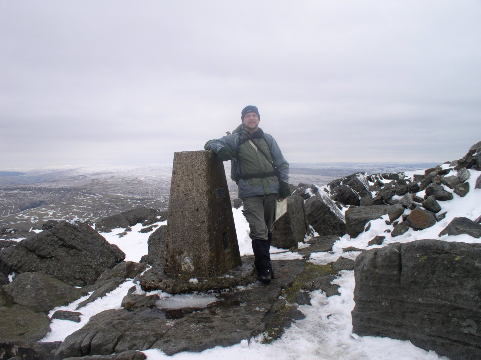
Stood by the trig point on Great Whernside - one of the original primary trig points this is one of the few to be maintained by the Ordnance Survey as part of the 'passive' network
The fate of the remaining 6,000 plus trig points has been mixed to say the least. Exposure to the more extreme elements our hills have to offer, including the danger of being hit by lightning, has left many in a fairly pitiable state of repair.

The trig point on the Cheviot has not aged well
Some trig points have become victim of the very ground they were originally situated on. This is particularly the case where trig points were situated in an especially peaty area. Trig points on Black Hill in the Dark Peak and The Cheviot needed to be rebuilt on stone plinths as they were in danger of sliding into the surrounding ooze. Peat erosion at other trig points, such as on Darnbrook Fell in the Dales and Hawthornthwaite Fell in the Bowland hills, has resulted in them now standing precariously on their now exposed foundations.

The trig point on Black Hill was rebuilt on a stone plinth to stop it from succumbing to the surrounding peat bog
In some places the surrounding countryside has changed so much that even if someone wanted to use certain trig points for taking measurements it would be practically impossible. A good example of this is the trig point that sits above Caley Crags to the east of Otley Chevin. When it was built it would have been possible to see some of the surrounding trig points in Lower Wharfedale. Today the trig point sits rather forlornly in a plantation with nothing in the vicinity but trees.

The trig point in Caley Deer Park now sits in a plantation and has views of nothing but the surrounding trees
While it is not surprising that nature and the elements have sometimes had an adverse effect on various trig points less understandable is the damage wreaked by actual people. I've been to several hills and mountains where the trig point is no longer to be found, or at least not in one piece. The first time I came across this was on Pen-y-Fan, the highest of the Brecon Beacons in Wales. One of the first 'missing' trigs in the Pennines was Parson's Pulpit between Malham and Littondale which stopped being marked on the OS maps some time ago.

Standing at the site of the missing trig point on Parson's Pulpit
I've not yet come across a reason why the trig point was removed. Possibly it was by a local landowner who wished to disuade 'trig baggers' from visiting the area. To actually remove a trig point must take some effort and clearly for some people the act of destruction rather than removal is enough. This seems to be the case on Meldon Hill where the broken sections of the trig point can still be found on the summit. What a pointless act. Do people really think they can put people off walking up a hill by smashing a harmless bit of concrete? Just looking at the picture below makes me feel quite angry.


Even more astonishing is that it is not just vandals or private landowners who have removed trig points. It may come as a surprise to some that the Yorkshire Dales National Park authority have also done so. There used to be a trig point on Addlebrough, a shapely hill in Wensleydale. Ostensibly to protect a nearby cup and ring marked stone the YDNP decided to dismantle Addlebrough's trig point and use the pieces to construct a cairn about 30m away. The logic behind this quite defeats me especially as, at the same time, they created a permissive path to the summit thus encoraging visitors!!


Thankfully it is not all doom and gloom for trig points. They are a welcome sight to many walkers who have toiled up steep slopes to the summit of a hill and in poor weather they are a extremely useful landmark. It is not surprising therefore that many people see them as national monuments to be loved and cherished. Individuals or local walking groups have even taken it upon themselves to maintain certain trig points. I recently visited the trig point on Broadstone Hill attached to which was a plaque commemorating the resiting of the trig point by a Saddleworth fell runners club in 1998, a few months after it had been knocked down by vandals.

The plaque on the Broadstone Hill trig point following its restoration in 1998 by a local fell runners group in Saddleworth
If, while walking in the hills, you come across a trig point adorned in a bright white coat of paint then the chances are that this trig point has its own, self-designated, guardian angel. Caught in the right light these white trigs really can be seen from miles away. To carry a paint and brush on to the hills requires some dedication and indeed there is a thriving community of trig enthusiasts both on the hills and online. One of my favourie websites is www.trigpointinguk.com, an online community of over 3,700 trig enthusiasts who log each visit they make to a trig point and upload photos of the trig points themselves. The site provides all sorts of fascinting data and is a real goldmine of information. The lengths some people go to visit a trig point, especially those that are in private land, can be quite entertaining. Some of these people are not even walkers but get in the car and go on trig bagging expeditions.

The brilliant white trig point on The Calf in the Howgill Fells
While some people may think such a pastime is a bit foolish and even a bit geeky (and here they may be right) it is ultimately these kinds of people who will ensure that the vast majority of trig points survive and for this they must be applauded. Personally though I think that some sort of governmental protection needs to be put in place to stop any more trig points from being wilfully damaged or removed. Perhaps at the same time they can pass a law stopping people from painting trig points anything other than white because quite honestly the trig point on Longridge Fell made me feel sick just looking at it. What were they thinking of!!!

Whoever thought painting the trig point on Longridge Fell this shade of yellow was a good idea needs to think again

Sunday, 21 November 2010

Pennine Trig Points: Part One

Anyone who goes walking in the hills and mountains of the UK will be familiar with the stones or concrete built pillars commonly referred to as trig points. Quite simply I love trig points and for some time I've wanted to post a blog about them. As I started to write this it quickly became apparent that it would be far too long so I've split it up into two. This blog which provides some background and history and a forthcoming post which will look at the mixed fortunes of trig points today.

Standing by the trig point on Simon's Seat - one of my favourite viewpoints in the Yorkshire Dales
Also known as triangulation stations or OS columns the first trig points were erected by the Ordnance Survey in 1935 as part of a long term project to re-map Britain. Overseeing the project, and the man credited with the design on the pillars was Martin Hotine CMG CBE (1898-1968), the head of the Trigonometrical and Levelling Division of the Ordnance Survey.

The trig point on Ingleborough - surely one of the most visited trig points in the UK
The trig points were usually situated on the highest ground in a particular area and the idea was that in clear weather it would be possible to see at least two other trig points from any one trig point. By sitting a theodolite on the top of the pillar it was thus possible to take careful measurements of the angles between the lines-of-sight of the other trig points. This process called 'triangulation' enabled the Ordnance Survey to construct a highly accurate measurement system that covered the entire country. The OS Landranger and Explorer maps we use today are a direct result of this project.

The trig point on Cross Fell, the highest trig point in the Pennines and still used as a passive station today
While many trig points are to be found marking the summit of a hill or mountain it was more important to the surveyors when selecting a spot that the trig point would be visible from at least two other trig points. This is why in some upland areas, particularly the Dark Peak area of the Peak District and the North Pennines, trig points are often found not on the wide flat summits but near the edge of steeper gradients. A classic example of this is the vast Kinder plateau where not one but three trig points have been sited at strategic points though not one of them is close to the actual summit of the mountain.

The trig point on Kinder Low, one of three trig points on the Kinder plateau
There were initally 300 'primary' trig points constructed across the country which over the next 30 odd years were supplemented by over 6,000 more. Over the 300 primary trig points a total of 18 were sited in the Pennines. From south to north these are as follows; Merryton Low, Harland Edge, Kinder Scout (North), Margery Hill, Black Hill, Winter Hill, Boulsworth Hill, Ilkley Moor, Ward's Stone (East), Great Whernside, Whernside, Water Crag, Cross Fell, Collier Law, Cold Fell, Sighty Crag, Tosson Hill and The Cheviot.

The trig point on Boulsworth Hill - one of the 300 primary trig points erected in the UK
I have often wondered what it must have been like for the people whose job it was to site and erect the pillars. For a start the Ordnance Survey must have initially had to negotiate access with local landowners. Presumably the succes or otherwise of these negotiations had a major impact on the actual positioning of certain trig points.

The trig point on Wolfhole Crag - one of the more remote trig points in the Pennines
While many trig points, particularly the lower level ones, are easy to access there are also some that were situated in particularly remote and hard to access areas. Remember this was in the days before the general public had access to much of our upland areas and there wasn't the network of paths and tracks that we enjoy today. Even today there are plenty of trig points that can only be reached by a long pathless march over rough terrain. Think what it must have been like to not only get to the projected site but to also carry the tools and materials for actually building the pillars.

Standing by the trig point on Fendrith Hill in the North Pennines - many of the trig points in the North Pennines can only be reached by a long march across pathless and often rough terrain
On the other hand what a wonderful task it must have been!! Maybe I'm just being a romantic but surely being out on the hills everyday building trig points beats working in an office. I'm certain that the OS surveyors must have had a fair few adventures along the way too, both in dealing with the elements and the local population. Were it not for the fact that many of those responsible for building the first trig points are now long since dead I imagine one could compile quite an entertaining book of anecdotes about their adventures.

The trig point on Windy Gyle is situated on an ancient burial cairn and is probably my favourite viewpoint in the Cheviot hills
In my next blog I'll look at trig points in the 21st century.

Monday, 8 November 2010

Reminiscences of 2004

Somewhat belatedly I've just finished adding to the site all my walks in 2004. I've still got another 35 walks that I did in the Yorkshire Dales in 2005 to add and then finally the site will be completely up to date.

One of the things I've most enjoyed about putting my website together has been the chance to re-live my hillwalking experiences from the last six years and these walks from 2004, the year it all started for me, have been no exception. Initially I began walking as a means to an end - the end being the Yorkshire Three Peaks Challenge walk. Our first walk was around Malham in March 2004 we then visited each of the Three Peaks individually to train for the big event.

Climbing up Gordale Scar on my first adventure in the Dales
After visiting Pen-y-Ghent, Whernside and Ingleborough we then started to explore the other major summits of the Dales such as Great Shunner Fell, High Seat, Buckden Pike and Great Whernside. By the time we completed the Three Peaks Challenge in September of that year we had not only decided to visit all the 2000ft summits in the Dales but had actually been to most of them. In doing so a whole new world opened up for us.

On the top of Ingleborough - the last summit on the Yorkshire Three Peaks Challenge
I first began making written notes of my walks in 2005. At the same time I retrospectively wrote up my thoughts on my walks from the previous year. Reading them now it brings back to me that sense of wonder and discovery that got me hooked so completely. When amending this initial text for my website I have actually had to water down the many superlatives I used when describing the things I had seen on these early walks. Features that may seem commonplace to me now were incredible at the time. For example, the tarns of the Dales cannot compete with their Lakeland counterparts but I'll always hold a special place in my heart for the tarns on Widdale Fell, the first upland tarns (excluding Malham Tarn) that I'd encountered.

Little Widdale Tarn

There are two things that strike me most about that first year of hill walking. Firstly, it is amazing how we stuck to it in the face of what was a fairly wretched year in terms of weather. On roughly half of the walks we encountered either hill fog, strong winds, heavy rain or more usually all three together. Nowadays poor weather can really put me off especially now that photography is such an important element for me. Back then though it was almost as if we relished it. That can be the only explanation for the quite frankly barmy decision to walk to High Pike Hill and back from High Seat in quite dreadful weather just to bag a summit which does not even qualify as a Nuttall.

Matt tries to measure the wind speed on Archy Styrigg

The other striking thing about that first year of walking was how quickly and willingly we forsook the public rights of way. Bearing in mind this was the year
before the CRoW Act came into force in the Dales we often took routes on what is now access land so that we could visit the tops of hills such as Great Knoutberry Hill, High Seat and Lovely Seat. While some of the routes came from books such as Brian Smailes 'Yorkshire Dales Top Ten' we often created the routes on our own without recourse to a walking guide. A few years later when I actually read John and Anne Nuttalls 'Mountains of England and Wales' I felt a quiet sense of satisfaction to see that some of their routes matched the ones we had come up with independently on our own.

Sat on the top of Lovely Seat
Our choice of routes combined with the fairly awful weather ensured that we quickly became adept at map reading. We also became acquainted with Pennine bogs which, again due to the weather, were particularly bad that year. Particular stand outs in this regard were Abbotside Common, parts of Fountains Fell and Birks Fell and almost the whole of Buckden Pike and Nine Standards Rigg.

Buckden Pike was a particularly wet place in 2004
The problem for me now is that having relived these walks I really want to revisit hills such as Gragareth, Great Coum, Swarth Fell and Rogan's Seat - summits that I have not been to since that inaugural walking season. I had been planning on making a sustained attempt at completing the Nuttall tops in the North Pennines as well as trying to get to the Peak District more often. It looks like those plans may be changing.